Assam Flood 2020- A Conceptual Study
The River Filled Eyes of Assam
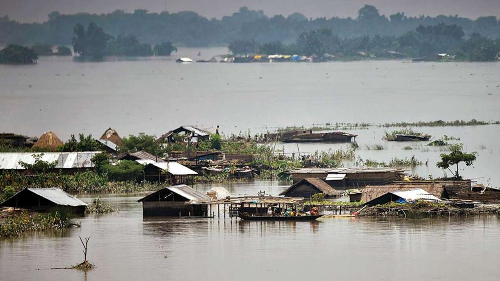
The “Brahmaputra floods of 2012” was one of a kind, that dismantled the state of Assam. The aftermath of “the great flood” was a wake-up call for the governments. The 2012 flood caused lives of 124 people including children. The Brahmaputra overflowed, breaching embankments, flooding both agricultural and residential regions, affecting a total of more than 6 million people. The flood showed no mercy even to the animals, flooding Kaziranga National Park and other 14 districts.
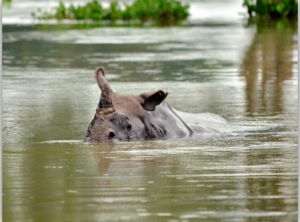
According the flood reports submitted by the government, about 540 animals died in the National Park – a sum of 16 one-horned Indian rhinoceros, numerous Asian Elephants, swamp deers, porcupines and water buffaloes- “ an integral part of food cycle”
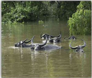
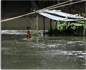
Breached embankments and flooded Kaziranga National Park (Source: Times of India)
Assam is a flood-prone state and it can be proved with the flood reports of 2013, 2015, 2016, 2017, 2018 and 2019 – Drowning more than 600 lives; a revenue loss of more than 2000 crore every year due to “Annual Floods”. Assam floods also have endangered many animal species – One-horned Indian rhinoceros, and Asian elephants.
“The last decade has reported a death of more than 100 rhinoceros by “Annual Floods- flooding the national park”
Assam flood in 2019 – Kaziranga National Park, Assam (Source: National Geographic)
Since 1950, 14 major floods have struck Assam, making the state “the most vulnerable areas to flood” in India.
2020 Assam Flood
This year is also a “no-stranger” to the Assam Floods. The government has reported it as one of the great floods of the decade.
The flood report depicts the intensity of the flood.
| Total number of people died | 66 |
| Number of districts affected | 28 |
| Number of villages affected | 3014 |
| Total crop area affected | 1,27,955(hectares) |
| Total population affected | 35,75,832 |
| Total number of relief camps and inmates | 711 , 51,421 |
| Animals affected | >25,00,000 |
(Source: Assam State Disaster Management Authority) (Dated:17/07/2020 )
Why is Assam such a flood-prone area?
The flood season in Assam commences at the month of June with the onset of the South-West Monsoon. Almost every year three to four waves of flood ravage the flood-prone areas of Assam.
5 prime reasons for “super-floods” in Assam.
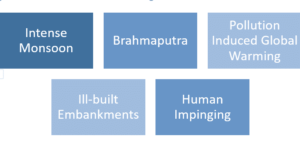
Intense Monsoon
The long-term rainfall data for Assam, however, shows a decreasing trend that has accelerated since 1981. The annual average rainfall for Assam is 1,524.6 mm. “Assam receives more rainfall than any other states”.
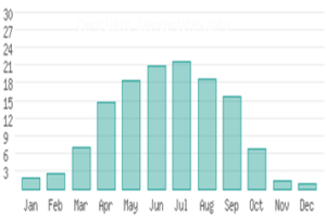
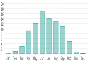
But as per the reports, the average rainfall in Assam is decreasing, but each year the flood is getting intensified. The reason is that there are many other interlinked factors causing the flood. But intense monsoon also imparts its role towards “Annual Floods”.
Brahmaputra River
Assam is built on the banks of the Brahmaputra. It divides the state into Northern and Southern Assam.
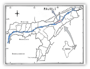
“Hydro-Geomorphic “ features of the state is mainly influenced by the geographic location and characteristic features of the Brahmaputra- width, areas over it flows, tributaries and riverine discharges.
source: Opindia News
Brahmaputra is both a boon and a curse for the Assamese. For half of the year, it is a boon- drinking water by huge underground water reservoirs, watering the crops, discharging natural fertilizers. For the rest of the year it is curse by flooding habitat and crops
“How come the river be a curse?”
Brahmaputra is a glacial river. It originates in the “Manasarovar Lake” region a close proximity to the Northern Himalayas.(Mount Kailash”).So it has huge water discharge throughout the whole year.
- The glaciers melts during the summer and the huge water discharge reaches Assam during the on-set of monsoon causing an increased water level till the off-set of monsoon.
- Brahmaputra is widened as it enters Assam. It can go as wide as 10 km during the monsoon, engulfing the banks. The average width is 6 km.
- Huge sediment discharge makes its tributaries braided which intensifies the “super flood” every year.
Pollution Induced Global Warming
Global warming is directly linked with uncontrolled melting of glacial ice which becomes a super source for the glacial rivers. It increases the water discharge into the rivers causing flood. ”Super floods “ in Assam is interlinked with the summer glacial discharge and monsoon discharge.
Glacial ice are a good reflectors of radiation. That means there is a negligible melting of ice due to absorption of radiation as they have comparatively high albedo ratio. So the enhanced glacial melting is an outcome of deposition of “black carbon” on ice. Black carbon has poor albedo ratio making them good absorbers of longwave radiation of the sun.
“The fine particles absorb light and about a million times more energy than carbon dioxide”.
Emission of industrial effluence causes high deposition of radiation-absorbing aerosols- black carbon and dust of industrial raw materials.
Black carbon concentrations near the Gangotri glacier rose 400 times in summer due to forest fires and stubble burning from agricultural waste, and triggered glacial melt, says a study by scientists at the Wadia Institute of Himalayan Geology (WIHG).
India is the second largest emitter of black carbon in the world, with emissions expected to increase dramatically in the coming decades. Black carbon is the second largest contributor to climate change behind carbon.
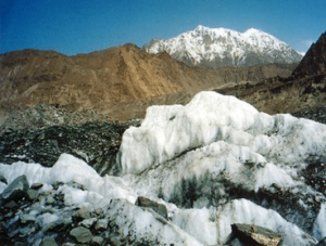
“The melting of glaciers in the Himalayas have doubled over the last two decades to around 20 inches in a year- which is equivalent to 3.2 million Olympic swimming pools of water every year”
Black Carbon deposited on Himalayan Glaciers
Source: Tree Hugger
Ill-built Embankments
- Assam’s flood management depends on the embankments built over regions where the river could overflow over the danger mark.
- “Embankments -bank of earth for constricting the overflow of flooded river over crops and residential areas.”
- Several hydro-electric projects (dams) over the river were planned but was of least efficiency cause it floods several areas of Arunachal Pradesh and low lysing Assam. The large width of the river also made these projects inefficient and impractical.
- Embankments have failed to constrict the overflow in Assam.
- Embankments in Assam are not built under proper studies and plans. Terrain is uneven and embankments built on uneven earth could not constrict flood over low lying regions even though it is embanked.
- Ill maintained and poorly constructed embankments.
- Flooding over braided tributaries have sunk several embankments due to “super discharge”.
- “197 earthen embankments have been damaged or breached this year”, reported by ASDMA.
- A mono-strategical approach towards the flood management is least efficient leaving the officials with no “Plan B”.
Human Impinging
- Human habitation near the embankments have increased vulnerability to floods. They are exposed to flooding due to poorly built domicile which cannot withstand “Annual Floods”. Government has taken no interest in rehabilitating people near embankments.
- Uncontrolled deforestation near the banks of the river – soil erosion which leads to overflow and as result land slides of elevated areas underneath it.
What next?
The government has failed to look into these primes and to make a study of it to control and manage flood.It has drowned thousands of lives of humans and animals.
“Governments are not addressing the problem at the source. – they are firefighting”.The measures of governments are “short term” and “amateurish”. An integrated studies of different flood-prone regions must be undertaken and manoeuvre must be guaranteed by the experts and governments.
[social-share align=”left” buttons=”facebook,twitter,pinterest,linkedin,whatsapp,telegram,copy”]
References:

1 Comment
Super.. Informative